Coastal Flood Threat Through Tuesday: Timing, Maps, and Travel Impacts Along I-95
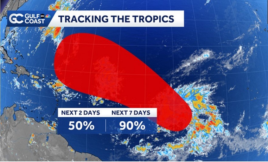 |
| A tropical depression or a tropical storm will likely form from this area later this week |
What’s Happening: Storm Overview
A coastal storm forming just off the coast of North Carolina is shaping up to deliver substantial weather impacts to the Mid-Atlantic region through Tuesday, with lingering effects possibly into Thursday.Though not named, its structure has warm-core characteristics and it is expected to bring:
-
Heavy rainfall of 2–4 inches, with some locations possibly getting up to 6 inches where precipitation is most persistent.
-
Significant coastal flooding—particularly around Norfolk, Virginia, the southern Chesapeake Bay, and portions of northeast North Carolina.
-
High surf and wave action (6-10 feet), dangerous beach conditions, and risk of rip currents along the coast.
-
Gusty winds (coastal and near inland) up to 40 mph, with power outage risk in exposed areas.
| Timeframe | Key Impacts Expected | Affected Areas |
|---|---|---|
| Monday (Sep 15) Afternoon / Evening | Rains begin spreading northward; first signs of coastal flooding at high tide | Outer Banks (NC), southern Chesapeake Bay, coastal Virginia (including Norfolk) |
| Tuesday | Peak storm tide: moderate to major coastal flooding; high surf; strong gusts; heavier rainfall | Virginia coast (Norfolk, Jamestown), northeastern NC, New Jersey coast, Delaware Bay region |
| Wednesday – into Thursday | Storm weakens but onshore winds persist; minor flooding and rough surf likely; residual travel disruptions | Coastal and Tidal zones from NC to NJ; I-95 corridor for inland wind and rain |
Flooding Forecast: Maps & Risk Zones
-
Norfolk, VA / Chesapeake Bay Area: Coastal flood advisories/warnings are in effect. High‐tide flooding will be moderate to major, especially in low-lying areas, with predictions that some waterways could be overtopped.
-
Jamestown & James River: River levels could reach ~4.9 ft, approaching major flood thresholds.
-
Duck, NC & Outer Banks: Persistent flooding during high tide; waves and surge pushing inland.
-
New Jersey Coast / Delaware Bay: Coastal flooding and high surf advisories likely; flood advisories are already posted.
Maps from National Weather Service and local weather offices show heavy rainfall accumulation north of the storm track, with the greatest risk near the coastline and adjacent tidal or river systems that may struggle to drain.
Travel & Infrastructure: Impacts Along I-95 and Beyond
-
Roadways: Expect coastal road closures and tidal flooding along shoreside highways (e.g. Virginian Tidewater roads, coastal Highway 17 in NC, coastal NJ roads). Interior I-95 may face tree or debris blockages due to gusty winds; some flooding near rivers.
-
Rail / Transit: Seaside commuter rail lines may face water on tracks; flooding near stations; schedule delays probable. Local transit in Norfolk / Hampton Roads and coastal NJ may be disrupted.
-
Air Travel: Delays possible for flights in Norfolk, Newport News, Richmond, and coastal airports if storms produce strong crosswinds or heavy rain — especially Tuesday.
-
Power: Storm‐driven wind gusts and saturated soil increase risk of fallen trees and downed lines; some temporary outages anticipated, particularly along the coast and in vulnerable terrain.
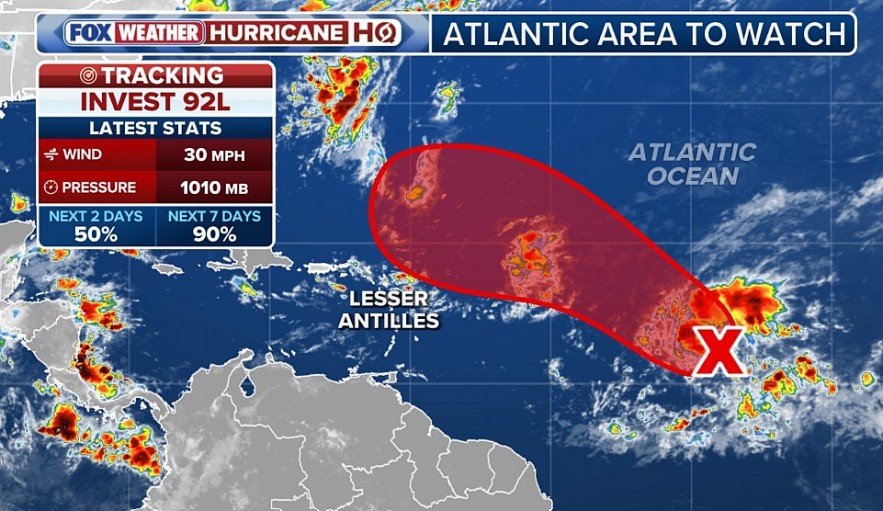 |
| Tropical Storm Gabrielle could form in the Atlantic this week while a coastal storm blasts North Carolina and Virginia with windswept rain and flooding concerns |
What Residents Should Do: Safety and Preparation Tips
-
Monitor local alerts: Coastal flood advisories, high surf warnings, and any evacuation orders.
-
Avoid driving through flood‐prone areas: Low bridges, roads that flood during high tide, and zones with poor drainage.
-
Secure outdoor property: Move furniture, boats, trash bins to prevent damage.
-
Prepare for power disruptions: Have flashlights, backup chargers, and nonperishable food supplies.
-
Stay updated via trusted sources: National Weather Service, state/local emergency management, and news outlets.
Why This Storm Matters
-
This event may rank among the more damaging non‐named storms for coastal flooding in the Mid-Atlantic, especially given rising baseline sea levels and coastal development.
-
Even after the storm weakens, residual tide & wind effects could prolong high surf, rip currents, and minor flooding through Thursday/Friday.
-
Infrastructure in many coastal areas is particularly vulnerable: roads, bridges, drainage systems that may not have design margin for this kind of combined surge + rainfall event.
FAQs
Q1: When will the coastal flood threat be highest in Norfolk?
A: Peak flooding in Norfolk is expected Tuesday, particularly during high tide periods—late morning into afternoon. Moderate to major flooding of tide‐affected streets is forecast.
Q2: What about New Jersey? When will flood advisories be in effect there?
A: Coastal flood advisories are already in place for New Jersey’s shore and tidal waterways; conditions will worsen Tuesday around high tide with moderate flooding and high surf.
Q3: Should travelers on I-95 expect delays?
A: Yes. Rain, flooding near waterways, and gusty winds may slow travel. Sections of I-95 near coastal interchanges and bridges are particularly at risk. Tuesday is the worst‐case scenario.
Q4: Is this storm a tropical system?
A: No. While it has some warm-core structure and heavy rain, it does not meet criteria for a named tropical storm. It is being tracked as a non‐named coastal low.
Q5: How long will conditions remain dangerous?
A: The storm’s worst effects should persist through Tuesday, with decreasing intensity through Wednesday. Coastal flood risk and high surf may linger into Thursday or even Friday along some shorelines.
Conclusion
The coastal storm sweeping over the Mid-Atlantic is more than a typical rainy spell. With high surf, heavy rain, and tidal flooding expected—especially in Norfolk, southern Chesapeake Bay, and New Jersey’s coast—residents and travelers should prepare now. Monday and Tuesday will be the most active days, with travel, infrastructure, and safety impacts likely. Stay alert, stay safe, and expect conditions to gradually ease mid-week, though coastal and flood hazards may linger.
 Severe Storms Sweep Through Pittsburgh: Photos, Videos Show Damaged Buildings, Downed Trees, Capsized Boat Severe Storms Sweep Through Pittsburgh: Photos, Videos Show Damaged Buildings, Downed Trees, Capsized Boat On April 29, 2025, severe storms swept through Pittsburgh and surrounding areas, bringing destructive winds, heavy rain, and widespread damage. Residents captured dramatic images and ... |
 Severe Thunderstorm Warnings Issued Across U.S as Dangerous Storm System Moves Through (May 3–5, 2025) Severe Thunderstorm Warnings Issued Across U.S as Dangerous Storm System Moves Through (May 3–5, 2025) Severe thunderstorms hit the Northeast and Mid-Atlantic U.S. with damaging winds, hail, and heavy rain from May 3–5, 2025, triggering widespread weather warnings and power ... |
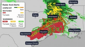 Severe Storms and Tornadoes Threaten South-Central, Northeast, and Southeast U.S. Severe Storms and Tornadoes Threaten South-Central, Northeast, and Southeast U.S. Severe weather outbreak slams South-Central, Northeast, and Southeast U.S. with tornadoes, flash flooding, and damaging storms. Find detailed forecasts, safety tips, and real-time alerts. |
 Tornado Outbreak Devastates Kentucky, Missouri, and Virginia: At Least 31 Killed Tornado Outbreak Devastates Kentucky, Missouri, and Virginia: At Least 31 Killed Tornadoes tore through Kentucky, Missouri, and Virginia on May 16, 2025, killing at least 31 and leaving widespread destruction. Full details, fatalities, rescue updates, and ... |


