Dangerous Winter Storm Underway Across the Midwest, Bringing Snow, Ice, and Hazardous Travel Into Monday
 Major Winter Storm Brings Snow, Ice, and Blizzard Conditions to 40 Million Americans Major Winter Storm Brings Snow, Ice, and Blizzard Conditions to 40 Million Americans |
 Weather Alert: Freezing Rain Threat in New York as Wintry System Lingers Through Monday Weather Alert: Freezing Rain Threat in New York as Wintry System Lingers Through Monday |
 |
| Dangerous winter storm underway today through Monday morning |
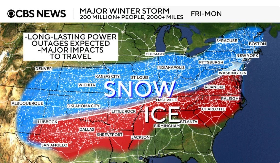
A high-impact winter storm is unfolding across large portions of the Midwest and Upper Midwest, prompting Winter Storm Warnings and Blizzard Warnings as snow, freezing rain, and powerful winds create dangerous conditions from Sunday through Monday morning.
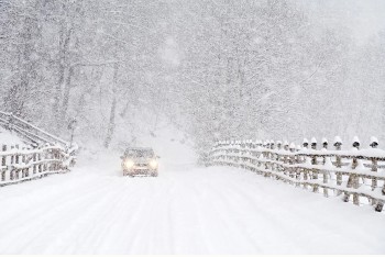
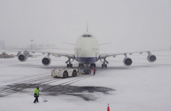
According to the National Weather Service, this system is particularly dangerous because of its combination of heavy snowfall, gusty winds, and rapidly falling temperatures, which can cause whiteout conditions and flash freezing on untreated roads. Forecasters warn that travel may become difficult to impossible at times, especially overnight and during the Monday morning commute.
Hardest-Hit Areas
The most severe impacts are expected across southern Minnesota, northern Iowa, and western Wisconsin, where snowfall rates may exceed one inch per hour at times. Wind gusts over 40 mph are likely to produce blowing and drifting snow, significantly reducing visibility on highways and rural roads.
In parts of southern Minnesota, blizzard conditions are expected through early Monday, with prolonged periods of near-zero visibility. Officials strongly advise against unnecessary travel in these areas.
Minneapolis
Snow intensified Sunday morning and continued through the afternoon, accompanied by strengthening winds. By Sunday night, blowing snow and drifting were expected to worsen, making travel extremely dangerous. Conditions may slowly improve Monday, but lingering snow and cold temperatures will keep roads slick.
Mankato and Southern Minnesota
This region sits near the core of the storm. Heavy snow, strong winds, and whiteout conditions are likely overnight Sunday into Monday morning. Local officials warn that emergency response times may be delayed due to hazardous road conditions.
Des Moines
Periods of snow and gusty winds are expected, with slick and snow-covered roads developing quickly. While snowfall totals may be lower than farther north, blowing snow and falling temperatures will still create hazardous travel.
Madison
Snow spreads east Sunday night into Monday, accompanied by strong winds. Drivers should expect reduced visibility and icy roads, especially on bridges and elevated surfaces.
Why This Storm Is Especially Dangerous
Meteorologists emphasize several key risk factors:
-
Heavy snow combined with strong winds, leading to whiteouts
-
Rapid temperature drops, causing wet roads to freeze quickly
-
Overnight timing, increasing the risk of accidents during low visibility
Even areas receiving modest snowfall can experience severe travel issues when winds increase.
Monday Morning Forecast
By Monday morning, snow is expected to gradually taper off from west to east. However, blowing snow, icy roads, and bitter wind chills will linger. Morning commuters should plan for slower travel, delays, and possible road closures, especially in rural and open areas.
Safety Guidance
Emergency managers urge residents to:
-
Avoid travel during active warnings
-
Slow down and increase following distance
-
Carry emergency supplies if travel is unavoidable
-
Monitor local National Weather Service updates frequently
Bottom Line
This is a dangerous and disruptive winter storm for the Midwest. Heavy snow, strong winds, and icy conditions will make travel hazardous through Monday morning, with blizzard conditions possible in parts of Minnesota and surrounding states.