Which Parts of the U.S. Are at Risk From Flooding, Snow, Ice, and Severe Storms This Week?

 |
| Winter storms will bring snow, ice, rain this week |
A complex winter weather system is sweeping across the United States, triggering dangerous weather conditions from the Pacific Northwest to the Northeast and into the South. According to the National Weather Service (NWS) and NOAA, this is not a single storm but a series of cold air masses and storm systems that will interact over several days—bringing heavy snow, freezing rain, flooding rainfall, strong winds, and the potential for severe storms and tornadoes.
Weather officials warn that conditions may change rapidly, with new warnings and advisories issued on short notice as the system evolves.
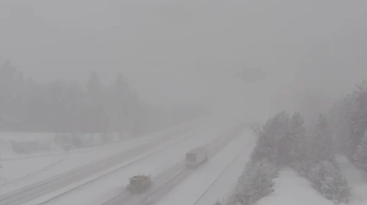
Northern U.S., Midwest, and Northeast: Heavy Snow, Ice, and Hazardous Travel
Timing: Tonight through the next 3–4 days (local U.S. time)
Large portions of the Upper Midwest, Great Lakes, and Northeast are expected to experience periods of heavy snow and mixed precipitation, especially near the rain–snow transition zone. Forecasts from weather.gov indicate that snowfall rates could be high at times, while nearby areas see rain changing to snow or freezing rain as temperatures fluctuate.
Most at risk:
-
Minnesota, Wisconsin, Michigan
-
Northern Illinois, Indiana, Ohio
-
Upstate New York and interior New England
Impacts:
-
Snow-covered and icy highways
-
Slippery bridges and overpasses
-
Poor visibility during overnight and early morning hours
-
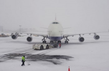
Flight delays and disruptions at major airports
The NWS notes that Winter Storm Warnings and Winter Weather Advisories may be expanded as snowfall bands shift. Ice accumulation—even light—could lead to downed trees, power outages, and dangerous driving conditions.
Pacific Northwest and the Rockies: Heavy Mountain Snow and Strong Winds
Timing: Ongoing through midweek
In the Pacific Northwest and the Rocky Mountains, forecasters are tracking significant mountain snowfall accompanied by strong winds, particularly at higher elevations. According to weather.gov, these conditions will make mountain passes treacherous and could produce blowing snow and whiteout-like conditions.
Areas of concern:
-
Washington and Oregon Cascades
-
Northern Idaho
-
Central and Northern Rockies
Key risks:
-
Dangerous interstate travel
-
Chain restrictions and road closures
-
Increased avalanche risk in backcountry areas
Officials urge travelers to check road conditions before departure and avoid unnecessary mountain travel during peak storm periods.
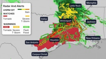
Central and Southern U.S.: Severe Storms and Tornado Monitoring
Timing: Late tonight through the next few days
As colder air pushes south and east, it will collide with warm, moisture-rich air across the central and southern U.S.. According to AccuWeather, this setup increases the risk for severe thunderstorms capable of producing damaging winds, heavy rainfall, and isolated tornadoes.
Highest concern areas:
-
Portions of the central Plains
-
Lower Mississippi Valley
-
Parts of the Southeast
Why this is dangerous:
-
Some storms may develop overnight, when people are asleep
-
Rapid storm development can limit warning time
-
Heavy rain may fall faster than drainage systems can handle
Forecasters emphasize the importance of having multiple ways to receive warnings, including mobile alerts and NOAA Weather Radio.
Flooding and Rapid Weather Changes Remain a Threat
Timing: Through the end of the week
Beyond snow and severe storms, the NWS warns that additional watches and advisories—including flood warnings, freeze alerts, wind chill advisories, and hazardous weather outlooks—may be issued quickly if conditions worsen.
Repeated rounds of precipitation, combined with snowmelt in some regions, could lead to localized flooding, especially in low-lying or poorly drained areas. Even locations that initially receive snow may later see rainfall that accelerates runoff.
What to Expect Over the Next 48–72 Hours
According to The Weather Channel:
-
Tonight: Parts of the northern and central U.S. will experience rain changing to snow, creating slick roads and reduced visibility
-
Next 48–72 hours: Cold air continues spreading eastward, pushing snow, rain, and gusty winds from the Midwest into the Northeast
-
Forecast confidence: High for travel impacts; moderate for exact storm tracks and snowfall totals
Meteorologists stress that small shifts in temperature could mean the difference between rain, snow, or ice—making local forecasts critical.
Safety Guidance From Weather Officials
Weather agencies urge residents in affected areas to:
-
Monitor official alerts frequently via NWS and NOAA
-
Delay unnecessary travel during snow, ice, or flooding
-
Prepare for power outages, especially where ice or heavy snow is forecast
-
Never drive through flooded roads—even shallow water can be dangerous
-
Pay special attention to overnight warnings, when severe weather is hardest to detect
Bottom Line
This multi-hazard winter weather pattern is expected to affect millions of Americans over several days. With snow, ice, flooding rain, and severe storms all possible, staying informed and prepared is essential. Officials emphasize that alerts may change hour by hour, and the safest response is to rely on trusted, official weather sources as conditions continue to evolve.