Tornado Watch Expanded Across Iowa, Minnesota, and Wisconsin Amid Intensifying Severe Weather Threat
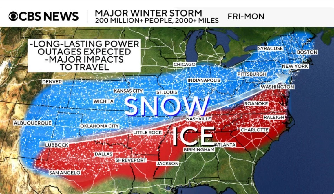
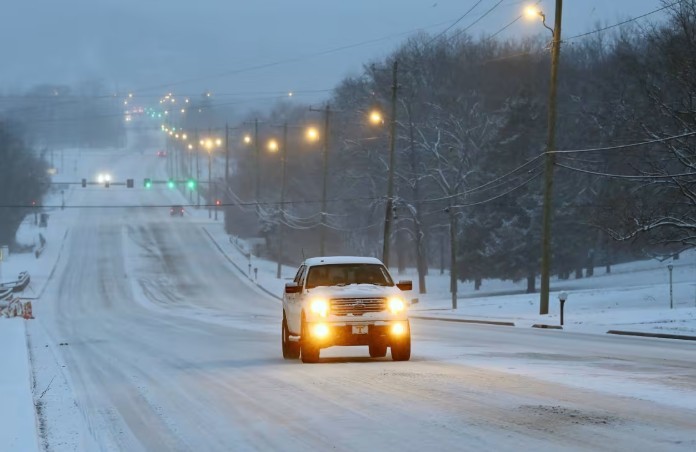
A dangerous severe weather outbreak is unfolding across the Upper Midwest today, prompting the National Weather Service (NWS) to issue multiple tornado watches and severe thunderstorm warnings across Iowa, Minnesota, and Wisconsin. Residents are being urged to remain vigilant as conditions deteriorate rapidly.
Read more: Severe Weather Forecast (April 28-30): Tornado Outbreak and Damaging Storms Threaten Central U.S.
 |
| A tornado watch has been issued for parts of Iowa, Minnesota and Wisconsin until 11 PM CDT. Image: X |
Tornado Watches and Warnings: Latest Updates
-
Tornado Watch #1: Covers southwestern Minnesota, including Marshall, Willmar, and Hutchinson, and northwestern Iowa. Initially set to expire at 8 p.m. CDT.
-
Tornado Watch #2: Covers central and southeastern Minnesota, including the entire Twin Cities metro area, and western Wisconsin. This watch is active until 11 p.m. CDT.
-
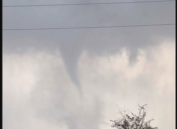
Confirmed Tornadoes: A tornado has been reported west of Fairmont, Minnesota.
Tornado Warnings are in effect for southeastern Benton County, north-central Sherburne County, west-central Isanti County, and south-central Mille Lacs County. Impacted cities include:
-
Princeton
-
Santiago
-
Glendorado
-
Pease
-
Princeton Airport
Blue Earth, Faribault, and Martin Counties have also been placed under warnings.
 |
| Severe Storms and Possibly Tornadoes |
Severe Weather Risk: High Alert for Millions
The Storm Prediction Center (SPC) has issued a Level 4 out of 5 (Moderate to High) risk for severe weather across parts of Minnesota, Wisconsin, and Iowa.
Potential hazards include:
-
Strong tornadoes (EF2 or greater)
-
Baseball-sized hail
-
Wind gusts exceeding 75 mph
The cities of Minneapolis, St. Paul, and Rochester, Minnesota, are squarely within the highest risk zone. Officials are warning that this could be the most significant severe weather event of the year so far for the region.
 |
| Risk outlook from Tuesday, April 29, at 8:00 a.m. ET to Wednesday, April 30, at 8:00 a.m. ET. Updated Monday, April 28, 2025 at 1:25 p.m. ET. Source: National Weather Service Storm Prediction Center |
Timeline and Expected Weather Impacts
Afternoon to Evening (2 p.m. – 11 p.m. CDT):
-
Early Afternoon: Isolated thunderstorms have already produced egg-sized hail in far southwestern Minnesota.
-
Late Afternoon into Evening: A cold front pushing east will trigger violent supercell development. Storms will rapidly organize into a dangerous squall line capable of widespread damage.
The "most dangerous period" for tornado formation is expected between 4 p.m. and 8 p.m. CDT.
Storm Evolution:
-
Supercells capable of producing strong, long-track tornadoes.
-
Transition to a line of storms producing destructive straight-line winds and embedded tornadoes.
Overnight: Storms will gradually move into Wisconsin and weaken slightly, though a severe threat will persist into early Tuesday morning.
Safety Recommendations
Authorities strongly advise residents to:
-
Monitor multiple weather sources — including NOAA Weather Radio, local TV, and mobile alerts.
-
Identify a shelter location — preferably a basement or an interior room on the lowest floor without windows.
-
Prepare emergency kits — with water, medications, flashlights, and batteries.
-
Avoid travel during peak storm hours.
Mobile homes and vehicles are especially dangerous during tornadoes. Seek sturdier shelter immediately if warnings are issued.
National Outlook: Broader Severe Threat Ahead
This Upper Midwest outbreak marks the beginning of several days of intense severe weather risks across the United States:
-
Tuesday: Over 1,800 miles from Texas to Vermont are under a Level 2 severe weather risk. A Level 3 risk exists across Ohio, Pennsylvania, and New York.
-
Tuesday Night: A flash flood threat grows in the Plains and Mississippi Valley due to heavy rain.
-
Wednesday: Severe weather shifts to the Southern Plains, but the intensity is expected to decrease by midweek.
The U.S. is pacing toward one of the most active tornado seasons on record, second only to 2011, with a tornado reported somewhere in the country for nearly two consecutive weeks.
Stay Connected
Given the rapidly changing conditions, it is critical to stay connected for real-time updates:
-
Check local National Weather Service offices.
-
Follow trusted meteorologists on social media.
-
Activate Wireless Emergency Alerts (WEA) on smartphones.
Conclusion
Today's tornado outbreak could become a historic event for the Midwest if forecasts verify. Preparation and awareness are key to ensuring safety. Stay indoors, stay informed, and act quickly if warnings are issued.
FAQs
Q1: What areas are under tornado watch today?
A: Parts of Iowa, Minnesota, and Wisconsin, including the Twin Cities metro area, are under tornado watches until late evening.
Q2: What time are severe storms expected to peak?
A: The most dangerous period is between 4 p.m. and 8 p.m. CDT, with severe thunderstorms and tornadoes most likely.
Q3: What threats are associated with today’s severe weather?
A: Strong EF2+ tornadoes, baseball-sized hail, wind gusts over 75 mph, and flash flooding are possible.
Q4: How should residents prepare during a tornado watch?
A: Monitor weather alerts, identify a safe shelter, prepare emergency supplies, and avoid travel during peak storm hours.
Q5: Will the severe weather continue into tomorrow?
A: Yes, the severe threat shifts east into parts of Ohio, Pennsylvania, and New York on Tuesday with continued risk of damaging storms.
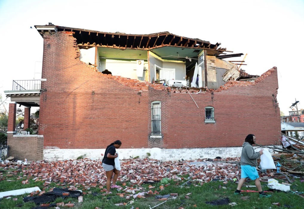
 Tornadoes Tear Through Houston Area, Leaving One Dead and Homes Damaged Tornadoes Tear Through Houston Area, Leaving One Dead and Homes Damaged Multiple tornadoes struck the Greater Houston area on Saturday afternoon, killing at least one person and injuring several others. |
 Monster March Storm Unleashes Tornadoes, Snow, and Destruction Across the U.S. Monster March Storm Unleashes Tornadoes, Snow, and Destruction Across the U.S. A powerful storm system, referred to as the "Monster March Storm," is currently sweeping across the United States, bringing a combination of severe weather events, ... |
 Severe Weather Across the U.S: Tornadoes, Fires, And Dozen Deaths Severe Weather Across the U.S: Tornadoes, Fires, And Dozen Deaths A powerful storm is sweeping the U.S., prompting a rare "high risk" alert. With over a dozen dead, tornadoes, fierce winds, and floods threaten millions. |
 Rare Earthquake Hits Magee, Mississippi, as Tornadoes Devastate the Region Rare Earthquake Hits Magee, Mississippi, as Tornadoes Devastate the Region Unprecedented dual disasters leave destruction, casualties, and communities in crisis |
 Tornado Strikes Rolling Fork, Mississippi, on Eve of 2023 Disaster Anniversary Tornado Strikes Rolling Fork, Mississippi, on Eve of 2023 Disaster Anniversary Tornado sirens blared across Rolling Fork on Monday evening as the National Weather Service (NWS) confirmed a tornado on the ground in Sharkey County, Mississippi. |