Winter Storm Threats Could Disrupt New Year’s Travel in 2026: Latest Forecasts, Biggest Impacts, and What to Expect
As Americans head into the final days of 2025 and prepare to ring in New Year’s 2026, forecasters are warning that severe winter weathercould disrupt travel, strain infrastructure, and complicate holiday plans across multiple regions of the country.
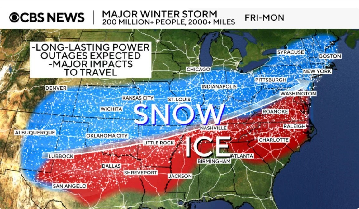
Meteorologists describe a volatile setup marked by Arctic air surging south, followed by one or more strong storm systems tracking through the Midwest and Great Lakes before spreading east. The result: snow, blowing snow, freezing rain, and damaging winds—sometimes all within the same 24-hour period.
Because this pattern coincides with one of the busiest travel windows of the year, even moderate weather impacts could have outsized consequences for roads, airports, and daily routines.
Read more: Dangerous Winter Storm Underway Across the Midwest, Bringing Snow, Ice, and Hazardous Travel Into Monday
 |
| Winter storm in Midwest has turned deadly |
What’s driving the late-December winter storm pattern
Forecasters point to a classic high-impact winter configuration:
-
A deep plunge of Arctic air into the Plains and Midwest
-
A strong low-pressure system tracking toward the Great Lakes
-
Sharp temperature contrasts that support snow, ice, and high winds
Even locations that avoid heavy snowfall totals may still experience dangerous conditions due to wind-driven snow, flash freezing, or icy roads.
Regions facing the greatest risk near New Year’s 2026
Upper Midwest: snow, wind, and dangerous travel
Parts of the Upper Midwest are expected to see accumulating snow combined with powerful wind gusts, creating blowing snow and near-whiteout conditions at times. Travel could become very difficult, especially on rural highways and interstates.
Behind the storm, bitterly cold air is forecast to settle in, with daytime highs struggling to climb out of the single digits in some areas. That combination raises concerns about vehicle breakdowns and frostbite risk for anyone stranded.
Great Lakes: whiteouts, lake-effect snow, and power concerns
The Great Lakes region faces a particularly hazardous mix. Strong winds interacting with lake-effect snow bands can cause rapidly changing visibility, where conditions deteriorate in minutes.
Wind gusts may be strong enough to down trees and power lines in some areas, increasing the risk of localized power outages just as families gather for the holiday.
Northeast: freezing rain and slick surprises
In parts of the Northeast, the bigger threat may not be snow totals but freezing rain and ice. Even light icing can make roads, sidewalks, and bridges treacherous—especially during evening travel.
Forecasts suggest a pattern where milder air briefly moves in, followed by colder temperatures that allow wet surfaces to refreeze, catching drivers and pedestrians off guard.
Southwest pockets: snow where it’s least expected
While winter storms are routine in northern states, some southern and southwestern areas could also see snow and icy conditions. These regions often have less road treatment and fewer drivers experienced with winter weather, increasing accident risk even with modest snowfall.
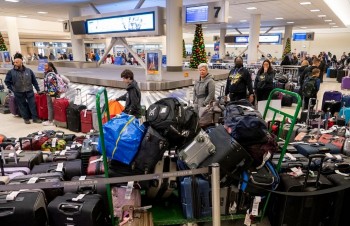 What Travelers Can Still Do When Winter Storms Cancel Hundreds of Flights What Travelers Can Still Do When Winter Storms Cancel Hundreds of Flights As winter storms cancel thousands of US flights, travelers still have options. Knowing when to rebook, reroute, or walk away can make the difference between ... |
How travel could be affected
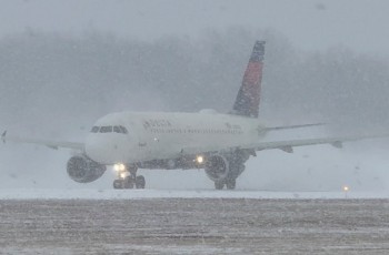
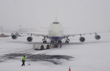
Air travel: delays can spread nationwide
Winter storms near major airline hubs can trigger delays and cancellations far beyond the storm zone. During peak holiday travel, tight schedules leave little room for recovery.
Travelers flying late in the day or with short connections are most vulnerable if weather disruptions escalate.
Smart travel tips
-
Choose earlier flights when possible
-
Monitor airline alerts and rebooking options
-
Pack essentials in carry-on bags, including medications and warm layers
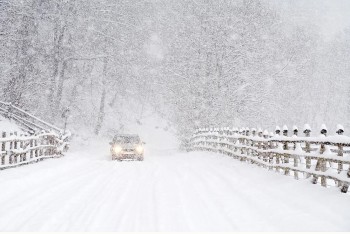
Roads: ice and wind often matter more than snow totals
Blowing snow can reduce visibility to near zero, while ice can turn ordinary commutes into serious hazards. Authorities urge drivers to avoid unnecessary travel during warnings and to check real-time road conditions before heading out.
Power and daily life
Strong winds and ice increase the likelihood of power outages, particularly near the Great Lakes and wooded areas. Families hosting New Year’s gatherings should be prepared with flashlights, charged devices, extra blankets, and alternative heating plans if available.
What to expect on New Year’s Day 2026
Looking toward Thursday, January 1, 2026, the broader pattern suggests:
-
Colder-than-normal temperatures lingering across the Midwest and Great Lakes
-
Scattered snow showers or flurries possible in parts of the Northeast
-
Continued wind-driven hazards in lake-effect snow zones
Because winter storm tracks can shift quickly, residents and travelers are advised to check local forecasts frequently, especially the night before and morning of travel.
FAQs
Will this weather affect New Year’s Eve celebrations?
In some areas, yes. High winds, icy surfaces, and falling temperatures could impact outdoor events, fireworks, and late-night travel.
Which areas face the most dangerous driving?
The Upper Midwest and Great Lakes are most at risk for snow combined with strong winds, while parts of the Northeast face higher ice potential.
Why can flights be delayed even if my city’s weather is fine?
Air travel is interconnected. Disruptions at major hubs can ripple across the entire national system.
What should drivers carry in winter storm conditions?
A full tank of gas, charged phone, warm clothing or blanket, flashlight, water, and snacks can make a critical difference if delays occur.